6-mile Hex Atlas of Earth
A downloadable hex atlas
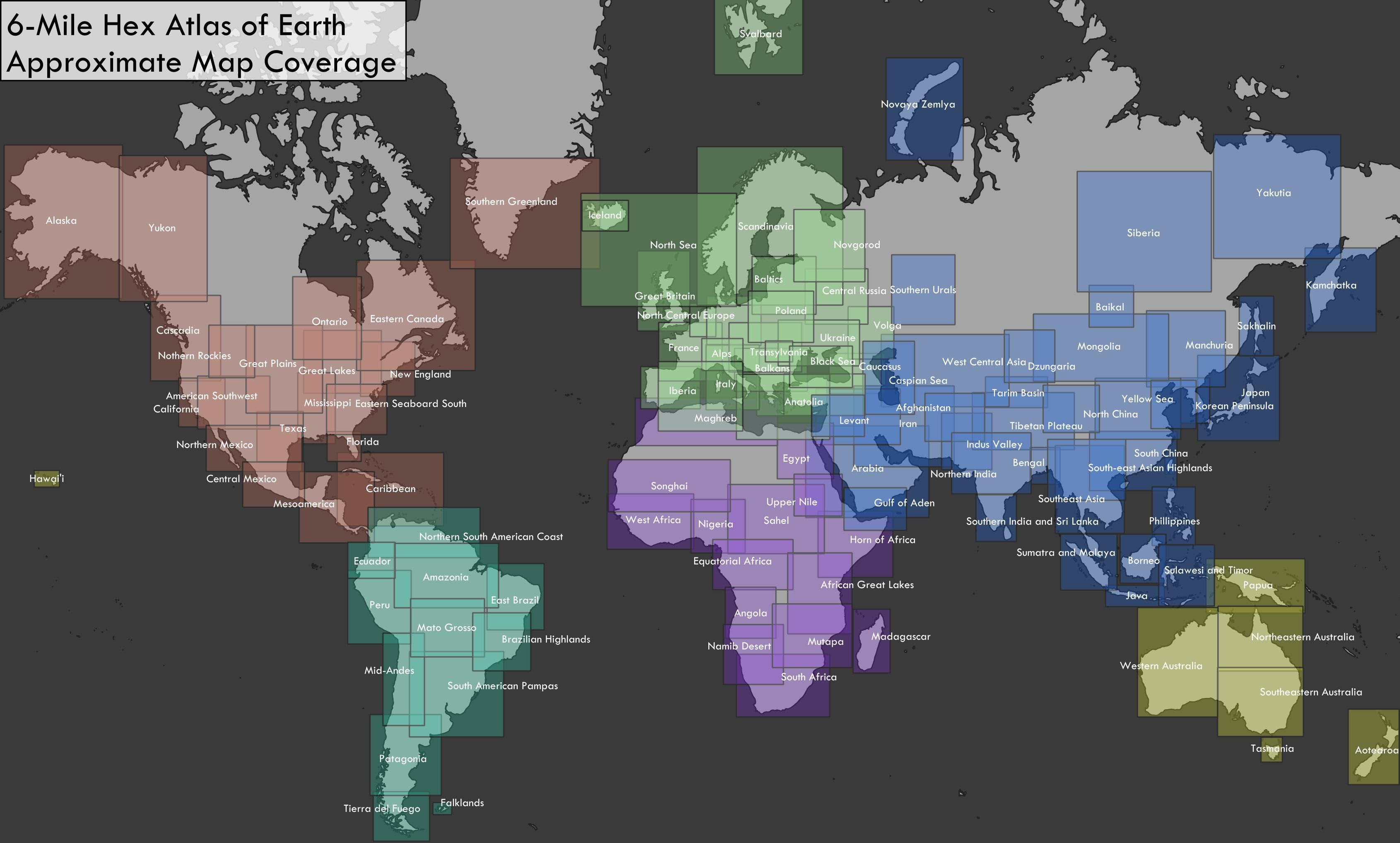
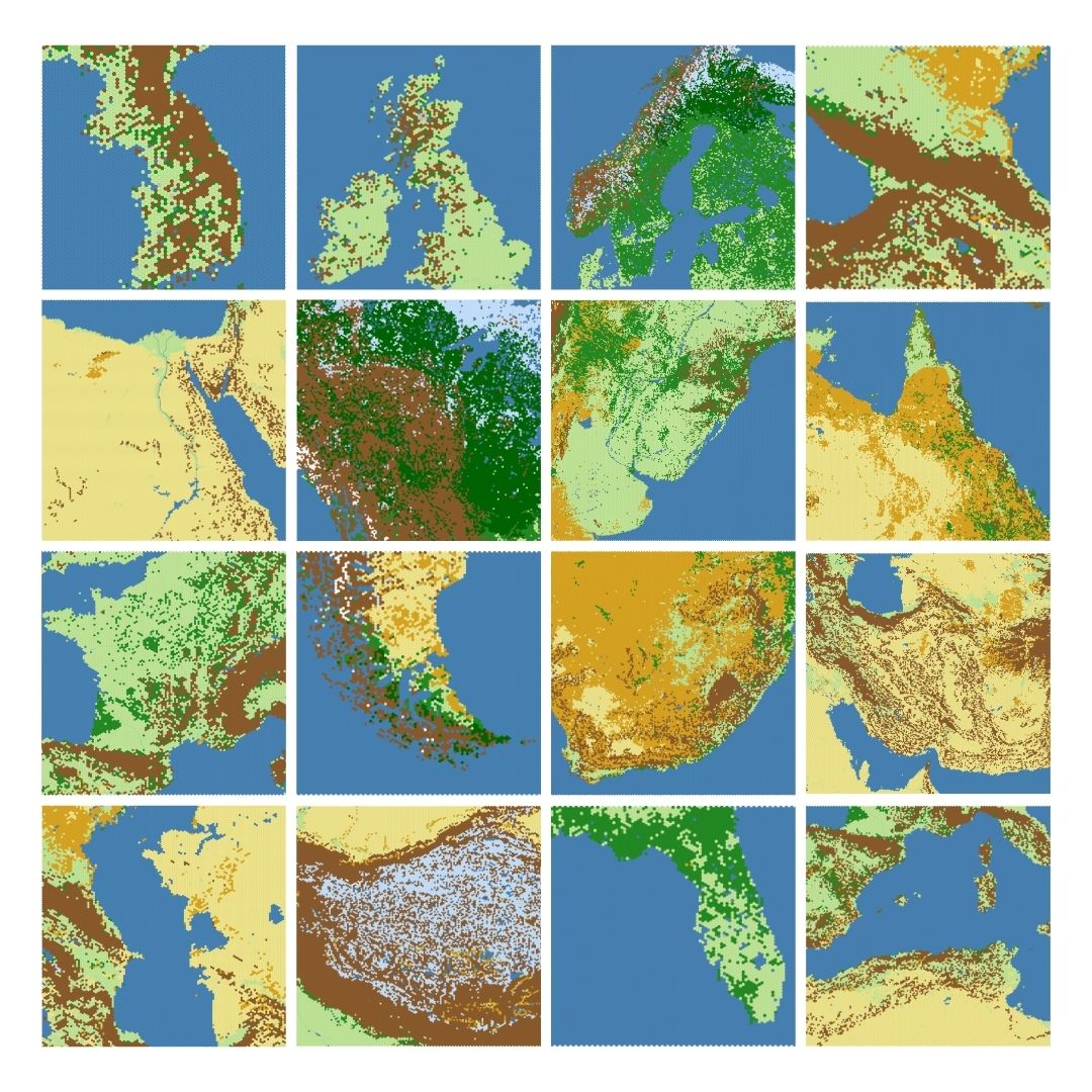
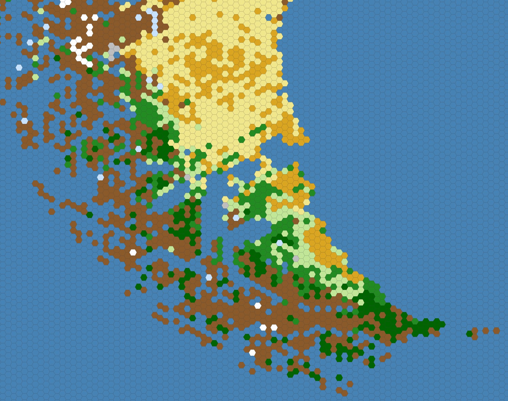
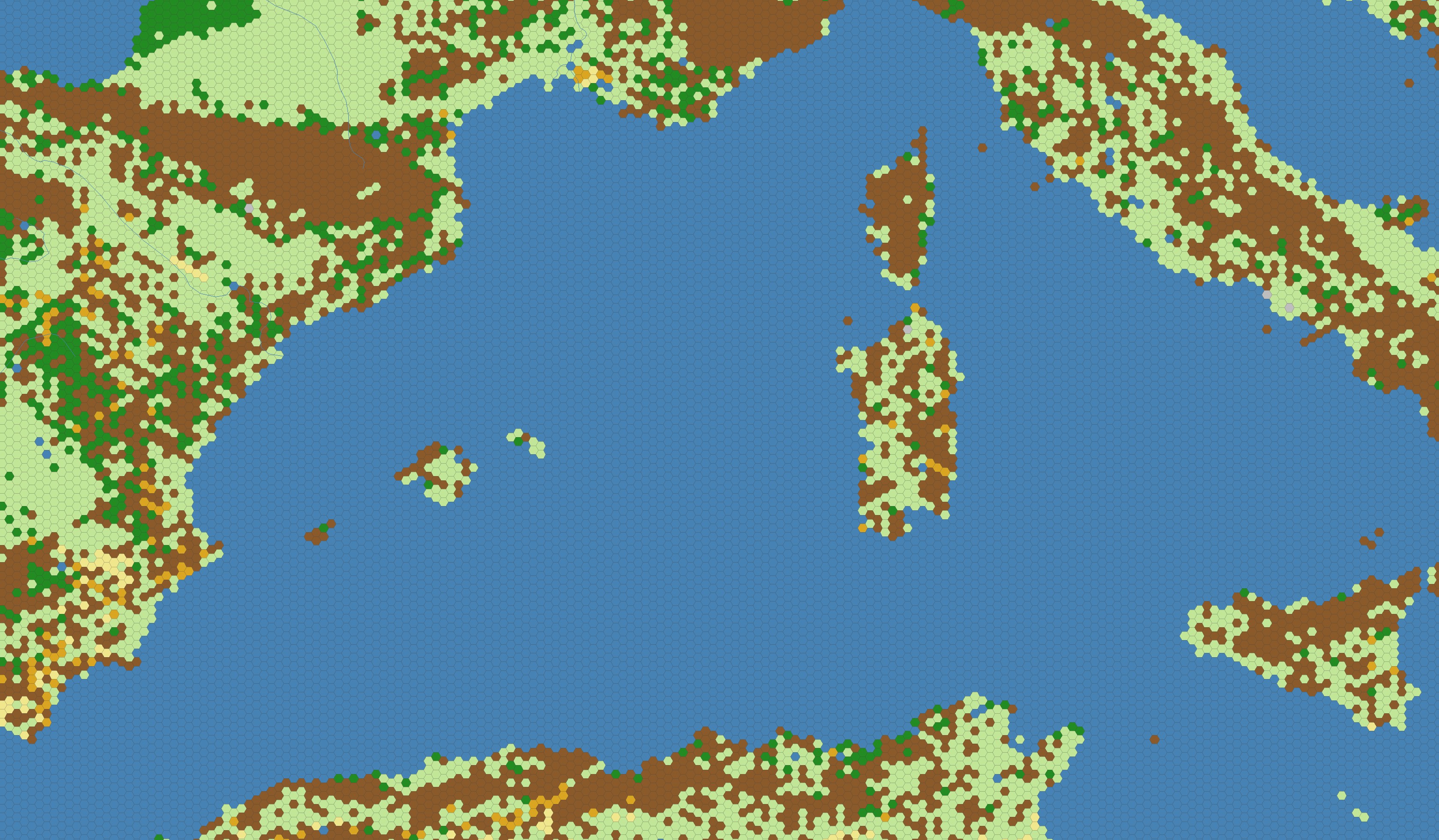
This is a collection of 118 maps depicting various parts of Earth as a grid of 6-mile hexagons, color-coded by terrain type.
Each map uses a custom Albers equal-area projection with standard parallels at the northern & southern borders of the bounding box. While imperfect, this mitigates most scaling issues at extreme latitudes. Additional details & source code are documented on my blog.
Map coverage was hand-delineated based on geography, history, & size constraints.
Limitations
These maps prioritize quantity over quality -- they're intended as a reference or starting point, not as a wholesale replacement for hand-made maps.
- To keep compilation time & disk space at reasonable levels, maps are low-resolution.
- Hex grids were generated separately for each area of interest, so they won't align perfectly with neighboring/overlapping maps.
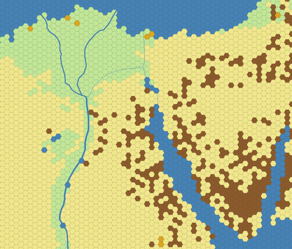
- Hexes currently lack row-colum indices.
- Terrain types are based on present-day data, so populated areas that could support forests will be skewed towards 'open' terrain due to modern farms & settlements.
- Mountain hexes are based on a statistical classification and don't always align with what one might hand-place.
- Major rivers are included but don't align well with coastlines. (This should be easy enough to manually fix using paint software, if needed)
- Some very remote areas in Canada, Siberia, and the Sahara are missing coverage.
Feedback on these points is welcome, but please note that generating maps is extremely slow so updates will be infrequent.
License
The ecological land units data used to inform the terrain is in the public domain and was developed by Roger Sayre:
Sayre, R., 2023, World Ecological Land Units (ELUs) 2015: U.S. Geological Survey data release, https://doi.org/10.5066/P9WRNPTN.
The map layouts in this repository are likewise public domain (CC0), though I appreciate a shoutout if you use them for something.
Download
Click download now to get access to the following files:
Development log
- 5-mile & full 3-mile coverage added7 days ago
- Added some 3-mile mapsMar 19, 2025
- 12-mile maps addedMar 18, 2025
Comments
Log in with itch.io to leave a comment.
These maps keep killing!! Would you ever consider doing hex maps of hypothetical/ prehistoric geography, such as Doggerland or Pangea?
Many thanks! Those are both great ideas. I’m currently working on mapping a terraformed version of the Moon, and after possibly Mars & Venus. But I’ll definitely see what prehistoric GIS data I can dig up and add those to the project queue.
I haven't taken a look at these, but the idea and effort of it are awesome! Having access to so many maps like this is great, good job.
Thank you, I hope they end up being useful!