The Great Antarctic Hexcrawl
A downloadable hex map
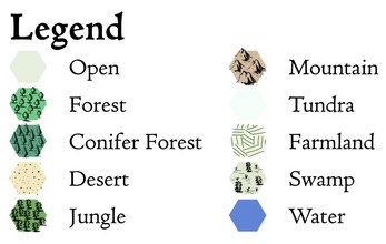
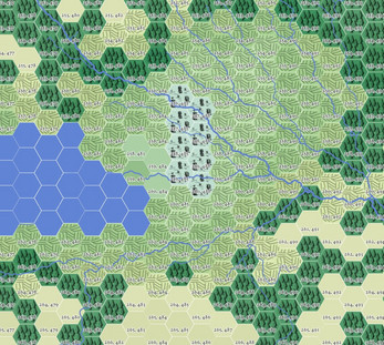
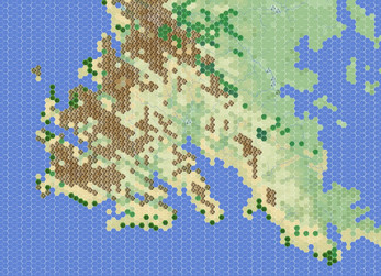
This is a hexmap (& associated GIS data) depicting a fantasy version of Antarctica with a temperate climate, intended for use with your TTRPG of choice.
The coastline & terrain were calculated by applying an isostatic rebound correction to Bedmap 2 data from the British Antarctic Survey. Biomes were estimated by training a random forest model on real-world temperature, elevation, & precipitation data and then applying it to warmer & wetter versions of real Antarctic climate data.
If you make a setting or adventure using these maps, consider joining the Antarctic Adventure Jam, running through Feb. 2026!
Files
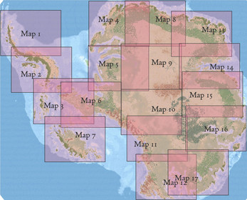
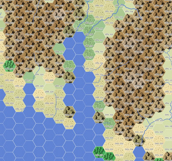
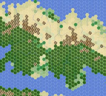
- Antarctica_maps.zip contains seventeen 600 x 800 mile maps covering the whole continent.
- Antarctica_hexes is a GIS point layer of hex locations with attributes for terrain, elevation, and row/column index. Provided as a .gpkg and .csv file.
- Antarctica_hexes.qgz is the QGIS project file used to make the maps. Edit this to alter the hex symbology.
- Antarctica_rivers.gpkg contains rivers calculated from Bedmap 2 terrain.
- Antarctica_elevation.tif is a 1000m resolution raster recording estimated post-glacial elevation in meters.
All data uses the Antarctic Polar Stereographic coordinate reference system. Hexes span approximately 6 miles.
Additional details are documented on my blog: Idraluna Archives.
License
Licensed under CC-BY-SA, so feel free to use it in your projects as long as you provide credit & share your work under the same license. Additionally, the Bedmap 2 readme requests that users cite the following paper:
Fretwell, Peter, Hamish D. Pritchard, David G. Vaughan, Jonathan L. Bamber, Nicholas E. Barrand, Robin Bell, Cesidio Bianchi et al. "Bedmap2: improved ice bed, surface and thickness datasets for Antarctica." The cryosphere 7, no. 1 (2013): 375-393.
| Status | Released |
| Category | Physical game |
| Rating | Rated 5.0 out of 5 stars (13 total ratings) |
| Author | idraluna-archives |
| Tags | antarctica, Hexcrawl, map, nsr, OSR, Tabletop role-playing game |
Download
Click download now to get access to the following files:
Development log
- Minimalist maps added39 days ago
- Hillshaded maps addedMar 30, 2025
- Blank outline addedMar 20, 2025
- Assets.zip updatedMar 01, 2025
- Antarctic Adventure JamFeb 13, 2025
- Overview MapsFeb 11, 2025
- Maps without farmlandFeb 07, 2025
- QGIS project file correctedFeb 06, 2025
Comments
Log in with itch.io to leave a comment.
This is fantastic! I'm a sucker for using real world maps, but there's always a lot of work in making them gameable. So happy to have found this, I'm pretty sure it'll hit my gaming table when my current campaign wraps up later this year.
This is astonishing work! Do you plan on releasing a version of the Map Key without the boxed references to the smaller maps?
Many thanks! And yeah, I can definitely do that – I assume for use as an overview map of the whole continent?
Exactly, yes. I’m using this map for my longtime campaign (it’s actually replacing the wonky map I made myself), and I want to map out geopolitical realms with it. I love this map!!
Awesome – I’ve added a color and greyscale overview map. Hope those work!
Thank you!
OH. MY. GOD
This is the single best hexmap I have EVER seen. Something as simple as "unfrozen antarctica" has been rendered in stunning detail and I am in love.
I've been thinking a lot about penguins, by sheer coincidence, and when I looked at these maps I could instantly imagine some grand flippered stories taking place in these lands. Sword and Shrimpery, perhaps?
I'll be borrowing this for my next adventure-- with credit, of course. So long and thanks for all the crawls!
So... game jam to fill Antarctica with adventures?
I've never run a game jam before but I'm open to it if there's interest!
Antarctic Adventure Jam 2025!
Looks great!.
What programs are .tif, .gpkg .csv and .qmd for? Don't recognize these
Thanks! I used QGIS (a free, open source, geographic information system) to make & render these files. All except the .qmd file could also be opened in ArcGIS or or another GIS package. And the .csv file can also be opened and edited in Excel or Google Sheets, as it's just a data table.
There's an old-ish tutorial for using QGIS for RPGs on my blog.
Brilliant work, thank you for sharing this.
Many thanks!
This is super cool, need to find more stuff like this to help with making worlds. One of my (many) biggest hangups is getting the world all made up, and this map helps take that away. Cool stuff!
Thank you! Yeah nothing like a few soft constraints to get past creative hangups.